
When studying geography, you might have come across the term “lines of latitude” and heard them being referred to as “parallels.” But have you ever wondered why they are known as parallels?
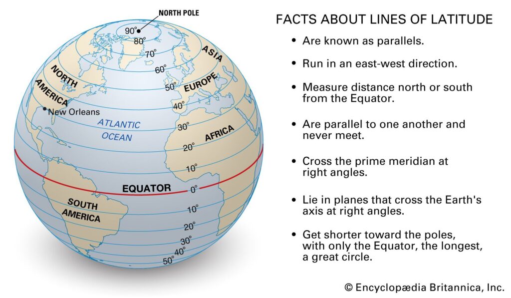
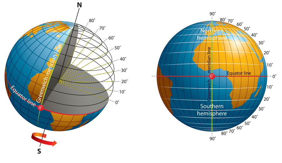
Lines of latitude, also known as parallels, are imaginary horizontal lines that encircle the Earth parallel to the equator. The term “parallels” is derived from the fact that these lines remain equidistant from each other as they circle the globe.
Credit: oceanservice.noaa.gov
The Reason Behind the Name
The name “parallels” reflects the characteristic that these lines maintain a constant distance from each other, running parallel to the equator. This parallel nature is what distinguishes them from the lines of longitude, which converge at the poles.
Credit: www.quora.com
Function and Significance
Parallels serve a crucial purpose in geography and cartography. By measuring distances north or south of the equator in degrees, they provide a systematic way of pinpointing location and navigating the globe.
From an aerial perspective, these horizontal lines create a grid that aids in the accurate mapping of our planet. This framework is essential for various applications, including navigation, climate studies, and understanding time zones.
Parallel in Mathematics
It’s interesting to note that the term “parallel” is not exclusive to geography; it is also utilized in the field of mathematics. In mathematics, parallel lines are those that remain equidistant to each other and will never intersect, much like the lines of latitude.
Frequently Asked Questions For Why Are Lines Of Latitude Also Called Parallels : The Parallel Truth
What Are Lines Of Latitude?
Lines of latitude are imaginary horizontal lines that circle the Earth, parallel to the equator.
How Are Lines Of Latitude Measured?
Lines of latitude are measured in degrees, minutes, and seconds using a system of coordinates.
Why Are They Called Parallels?
Lines of latitude are called parallels because they are always an equal distance apart and never intersect.
What Is The Purpose Of Lines Of Latitude?
Lines of latitude help us determine and locate positions on the Earth’s surface in relation to the equator.
Conclusion
Lines of latitude are aptly named “parallels” due to their parallel nature, sharing a significant characteristic with parallel lines in mathematics. Their crucial role in geography and cartography highlights the importance of understanding and appreciating these imaginary yet indispensable geographic delineations.